Introduction
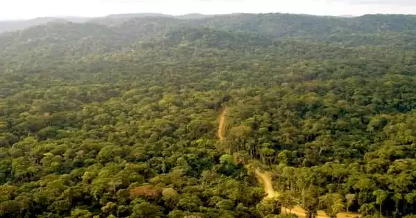
The Mau Forest Complex is approximately 170 kilometers north of Nairobi. While the forest was designated as Crown land in the 1930s and a national reserve in 1945, it was designated as a forest reserve under the Forest Act in 1954. The forest is Kenya’s biggest remaining indigenous forest. It is the largest of the country’s five water towers and the largest closed-canopy forest ecosystem, covering over 400,000 hectares. The forest is bounded on the west by Kericho County, on the south by Narok, on the north by Nakuru, and on the southwest by Biomet. It is separated into seven blocs: South-West Mau, East Mau, Oldonyo Purro, Transmara, Maasai Mau, Western Mau, and Southern Mau.
In the Rift Valley and western Kenya, the Mau Forest Complex is the most important water catchment. Freshwater provisioning, river flow regulation, flood mitigation, groundwater recharging, erosion control, water purification, biodiversity protection, and microclimate regulation are all important environmental services provided by the country’s rainforests. Agriculture and tourists benefit from the MFC’s ecosystem services.
The MFC is the upper catchment region for 12 rivers that run into five large lakes: Baringo, Nakuru, Natron, Turkana, and Victoria. It also supplies water to metropolitan areas. Three of these lakes, Natron, Turkana, and Victoria, are international bodies of water. The MFC supplies water to the Mara and Serengeti habitats, as well as the River Nile’s water resources, as five of the Nile’s 12 major tributaries feed Lake Victoria.
Climate
The weather conditions range from chilly to hot and humid. The lower sections of the Mau catchment region also have dry and semiarid environments. The average annual rainfall is 750 mm, with the majority of it falling between November and December and April and May. With rising altitude, the total yearly rainfall increases and becomes more predictable.
Facts and Figures
- Over the last decade, more than 50,000 people have been forcibly evacuated from Kenya’s environmentally significant Mau Forest.
- • With limited choices for relocating, evicted smallholders and others are nonetheless entering the forest in search of pasture and fuel.
- The Kenya Water Tower Agency installed electric fence, but encroachers tore it down in parts.
- Enlisting evictees to plant trees and provide assistance for alternative livelihoods is a step in the right direction.

Abstract
The Mau Forest, located in western Kenya, is East Africa’s biggest remaining near-continuous block of indigenous forest. It is a biodiversity hotspot, home to a diverse array of wildlife and vegetation, some of which are endangered. The Mau is significant as a water tower that feeds rivers and lakes, hence supporting the livelihoods of millions of people in Kenya and the surrounding region. An estimated 2000 km2 of the forest has been lost in the Mau during the previous 20 years, resulting in environmental, social, and economic damage. As a significant water tower, the impact of this loss is seen in reduced water levels in the rivers that flow from this forest, as well as higher temperatures. Furthermore, economic losses in agriculture, tourism, and energy industries damage people’s lives not just in areas near the Mau, but also in neighboring countries. The continued degradation of the Mau forest deprives the country of national heritage and is of regional and global importance. Attempts to restore the Mau have met with little success, necessitating diverse local and international assistance.


