close

Tourism

Tourism

East Africa’s Largest Surviving Indigenous Forest – Mau Forest

Introduction

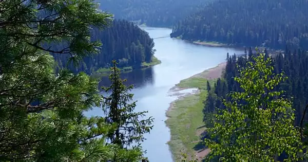
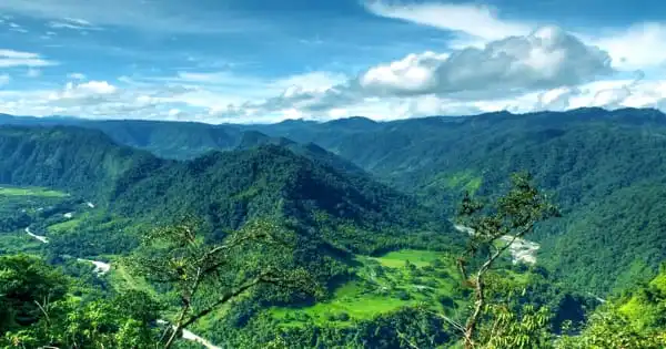
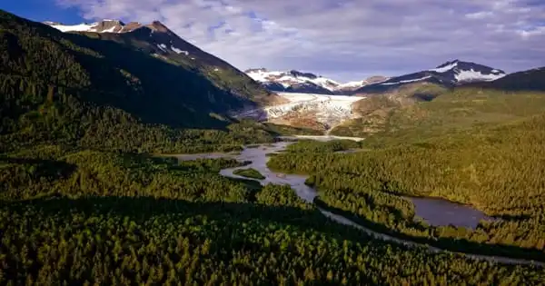
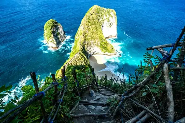
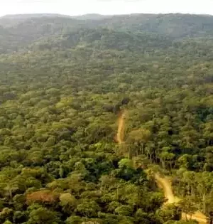
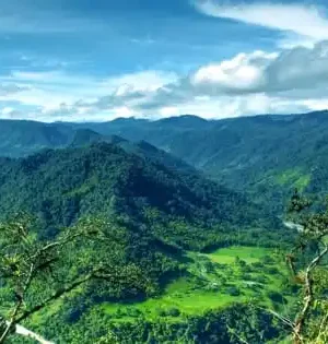
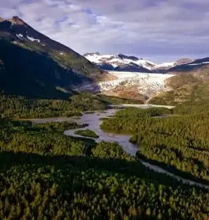
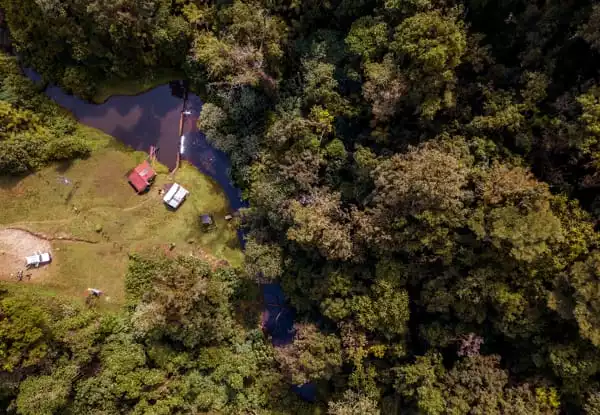
The Mau Forest Complex is approximately 170 kilometers north of Nairobi. While the forest was designated as Crown land in the 1930s and a national reserve in 1945, it was designated as a forest reserve under the Forest Act in 1954. The forest is Kenya’s biggest remaining indigenous forest. It is the largest of the country’s five water towers and the largest closed-canopy forest ecosystem, covering over 400,000 hectares. The forest is bounded on the west by Kericho County, on the south by Narok, on the north by Nakuru, and on the southwest by Biomet. It is separated into seven blocs: South-West Mau, East Mau, Oldonyo Purro, Transmara, Maasai Mau, Western Mau, and Southern Mau.

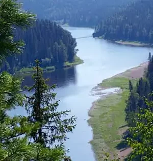
In the Rift Valley and western Kenya, the Mau Forest Complex is the most important water catchment. Freshwater provisioning, river flow regulation, flood mitigation, groundwater recharging, erosion control, water purification, biodiversity protection, and microclimate regulation are all important environmental services provided by the country’s rainforests. Agriculture and tourists benefit from the MFC’s ecosystem services.

The MFC is the upper catchment region for 12 rivers that run into five large lakes: Baringo, Nakuru, Natron, Turkana, and Victoria. It also supplies water to metropolitan areas. Three of these lakes, Natron, Turkana, and Victoria, are international bodies of water. The MFC supplies water to the Mara and Serengeti habitats, as well as the River Nile’s water resources, as five of the Nile’s 12 major tributaries feed Lake Victoria.

Climate

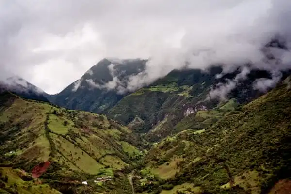
The weather conditions range from chilly to hot and humid. The lower sections of the Mau catchment region also have dry and semiarid environments. The average annual rainfall is 750 mm, with the majority of it falling between November and December and April and May. With rising altitude, the total yearly rainfall increases and becomes more predictable.

Facts and Figures

  • Over the last decade, more than 50,000 people have been forcibly evacuated from Kenya’s environmentally significant Mau Forest.
  • • With limited choices for relocating, evicted smallholders and others are nonetheless entering the forest in search of pasture and fuel.
  • The Kenya Water Tower Agency installed electric fence, but encroachers tore it down in parts.
  •  Enlisting evictees to plant trees and provide assistance for alternative livelihoods is a step in the right direction.


Abstract

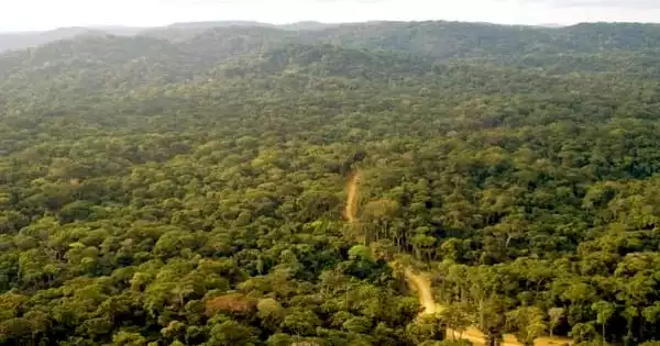
The Mau Forest, located in western Kenya, is East Africa’s biggest remaining near-continuous block of indigenous forest. It is a biodiversity hotspot, home to a diverse array of wildlife and vegetation, some of which are endangered. The Mau is significant as a water tower that feeds rivers and lakes, hence supporting the livelihoods of millions of people in Kenya and the surrounding region. An estimated 2000 km2 of the forest has been lost in the Mau during the previous 20 years, resulting in environmental, social, and economic damage. As a significant water tower, the impact of this loss is seen in reduced water levels in the rivers that flow from this forest, as well as higher temperatures. Furthermore, economic losses in agriculture, tourism, and energy industries damage people’s lives not just in areas near the Mau, but also in neighboring countries. The continued degradation of the Mau forest deprives the country of national heritage and is of regional and global importance. Attempts to restore the Mau have met with little success, necessitating diverse local and international assistance.

read more
Tourism

Russia’s The Virgin Komi Forest

The Virgin Komi Forests are a huge rainforest in Russia’s Ural mountain range, located in the northwestern section of the country. Russia’s Komi Republic owns the woodlands. The forests are Europe’s biggest virgin rainforests, covering 32,800 square kilometers.

Russian magnificence is represented by the Virgin Komi Forests. It’s a forest of aspens, conifers, birches, peat bogs, natural lakes, gorgeous rivers, and whatever else you’d expect to find in northern Europe. The Russian government has been protecting the forest for more than 50 years. The biggest pristine boreal forest in Europe may be found in this region.

Geographic Description

The vast rainforest may be found in Komi Republic’s northeastern section. The rich green forests of the forest beautify the western slopes of the northern Urals. The rainforest is dominated to the east by the Northern Urals, which are aligned north-south. Glacier forms may be seen in the mountains. During your journey, keep an eye out for the Telpossky massif, which showcases the glacier’s grandeur. If you haven’t seen a complex karst system before, have a look at the caves, craters, and river beds that are flooded annually. They were produced by the Urals’ foothills limestone being eroded. The area’s attraction is increased even more by the reef formations that have formed over time. During the Ordovician epoch, the oldest one was produced. Marshes, lowlands, and hills dominate the terrain, which eventually gives place to the Ural Mountains.

Climate

At this location, the Northern Urals features a continental climate with chilly winters and pleasant summers. In January, the average temperature is -17°C; in July, the average temperature is 10°-12°C in the highlands and 14.5°-20.5°C in the lowlands. The average annual rainfall in the foothills is 525mm, whereas in the mountains it is 7-800mm. For seven months, there is a layer of snow covering the ground to a depth of 100cm. The western slopes of the mountains have a higher humidity level than the eastern slopes.

Threat

They’re in danger since there’s a lot of gold in the location. Illegal logging poses concern as well. Since its inscription, the site has faced few threats. However, it remains vulnerable to gold mining exploration as long as the status of the gold mining license remains ambiguous. The establishment of full-scale gold mining operations on the property would pose a significant danger to its Outstanding Universal Value and integrity. Visitation has also had an impact, as has the rising tourist industry. The market is also a potential threat, should it not be managed effectively throughout the site.

Visitors

The Virgin Komi Forests are a large expanse of natural beauty that would enthrall any visitor. This huge expanse of the country contains a diverse range of locales, each with its own unique tale to tell. This is a list of locations in Komi that visitors can visit.

  • Weathering pillars on Mount Manapupuner

  • Shaman Mountain, which is also known as Mount Yerkusey

  • Bogatyr – Split Rock

  • The protected Schugor River and many more.
read more
Tourism

Birdwatching Hotspot Mindo Cloud Forest

Description

The Mindo Valley is located in northern Ecuador, on the western slopes of the Andes Mountains. It is well-known for its numerous bird, butterfly, and orchid species. The Mindo-Nambillo Cloud Forest and Ecological Reserve is located in the valley. The Mindo – Nambillo Cloud Forest, which covers over 47,000 acres and is located near the small community of Mindo, is the reserve’s most notable feature. The Guagua Pichincha Volcano, which rises to a height of 4,784 meters, or 15,696 feet, and can be seen from Quito on its eastern face, is the highest point in the reserve.

What is Cloud Forest?

Cloud forests are the flora of tropical highland areas with significant rainfall and constant condensation caused by the cooling of rainwater pushed higher by the mountains. A cloud forest is also known as a montane rainforest.

Plants and animals

Mindo’s most notable flora riches is its orchid diversity, with over 4,500 species. Among the flora are cedar trees,
Avocado, arrayan, cinnamon, and plants such as berries, hill red peppers, and nettle.

Mindo is a fantastic area to go birding. The forest also supports over 400 bird species, including partridges, hummingbirds, woodpeckers, and the secretive Andean cock-of-the-rock. Other animals include butterflies, bats, squirrels, deer-coated bears, and tiny amphibians.

Why Mindo Cloud Forest is known for?

The Mindo Cloud Forest is a one-of-a-kind eco-system in Ecuador famous for its biodiversity and birdwatching. In addition to various bird species, the lush subtropical forest provides a magical setting in which to explore and pursue adventure.

Difference between Cloud Forest and Rainforest

Lowland Rainforests are less lush and colder than Cloud Forests. Another distinction is that Rainforest rivers are bigger, silt-laden, and slow-moving, whereas Cloud Forest rivers are fast-moving, clean, and rocky. Because of the uneven, steep topography, cloud woods provide spectacular vistas. This is significant in terms of species dispersion. Because of natural obstacles, Cloud Forests have numerous limited or endemic species, as well as many tree species and epiphytes, such as Orchids. The Mindo-Nambillo Forest Reserve is a private reserve known for its remarkable diversity of wildlife and vegetation, making it a popular destination for eco-tourists.

Tourist

The Mindo Valley is one of Ecuador’s most popular tourist destinations. “The Ecuadorian Ministerio de Turismo” recently declared Mindo the Ruta de Cacao. Rafting, tubing, trekking, mountain biking, canyoning, horseback riding, birding, Chocolate Making, and helping are just a few of the activities that attract about 200,000 visitors each year. It has various private reserves and lodges noted for its montane forests, waterfalls, and distinctive cloud forest species, in addition to its well-developed tourism infrastructure. A large portion of the area is privately owned, while the Mindo-Nambillo Ecological Reserve covers an additional 86 square kilometers.

The majority of tourists to Mindo Ecuador are only two hours distant by bus from Quito, making it a convenient weekend getaway or even a day excursion from the city. Mindo is a simple addition to any short Quito itinerary, even if you’re only passing through. Buses run multiple times a day between Quito and Santo Domingo; however, buses from surrounding cities, such as Santo Domingo, are also available.

read more
Tourism

The Largest National Forest In The United States – Tongass National Forest

About Tongass National Forest

With 16.7 million acres, the Tongass National Forest in Southeast Alaska is the largest in the United States. The majority of the land is temperate rain forest, and it is distant enough to support numerous endangered and uncommon species of flora and wildlife. The Tongass National Forest, which is maintained by the US Forest Service, includes the Alexander Archipelago’s islands, fjords and glaciers, and Coast Mountains summits. The summit of the Coast Mountains’ Boundary Ranges forms an international boundary with Canada. Ketchikan Forest Service offices manage the forest. Craig, Hoonah, Juneau, Ketchikan, Petersburg, Sitka, Thorne Bay, Wrangell, and Yakutat each have a local ranger district office. Tlingit, Haida, and Tsimshian peoples call it home.

Species

The area has the world’s largest full temperate rainforest, which is shared with British Columbia’s Great Bear Rainforest to the south. The Tongass National Forest is an island archipelago of infinite streams, glacial fjords, and green valleys that back into the Rocky Mountains and enormous forests of towering, old-growth cedar, spruce, and hemlock trees that runs 500 miles north to south. All five Pacific salmon species may be found in the Tongass, as well as brown (grizzly) bears, wolves, Sitka black-tailed deer, Bald Eagles, Northern Goshawks, and Marbled Murrelets.

Why it is so Important?

The Tongass is the Crown Jewel of the United States’s National Forests. It has the biggest complete stands of coastal temperate rainforest on the globe, making it an increasingly uncommon global asset. It’s a place where the forest meets the sea, and as a result, it’s home to some of the world’s most thriving wild salmon populations. For thousands of years, these fish have provided food for the area’s indigenous inhabitants. Brown bears, wolves, and bald eagles thrive there, as does a thriving local fishing culture. It is crucial to help minimize climate change by keeping this incredibly enormous forest intact.

Tourism

It is renowned as the biggest forest in the United States of America, with approximately one-third of its entire area designated as wilderness. Its deep evergreen forest is dominated by western Sitka spruce, western hemlock, and red cedar. The Tongass National Forest’s glaciers are well-known as one of the most popular tourist attractions.

Each year, hundreds of thousands of visitors go to the Tongass in the hopes of witnessing its majesty: two-hundred-foot-tall spruce and 500-year-old cedar trees rising overhead.

Threats

The Tongass National Forest, America’s biggest national forest, is still under threat from fresh legislative efforts to clear-cut rare and important old-growth trees. Furthermore, the previous Trump administration revealed intentions to release a final Alaska-specific Roadless Rule in October 2020, abolishing roadless safeguards for the Tongass National Forest and allowing millions of acres of priceless old-growth temperate rainforest to clearcut logging. Alaska state officials and the Alaska congressional delegation are attempting to impose on local communities and the region’s economies something they do not want or need: a resurgence of large-scale clear-cutting and an attempt to resurrect an industry that accounts for less than 1% of the region’s economy.

read more
Tourism

The Dead Sea

Introduction

The Dead Sea is a Salt Lake in southwestern Asia, lying between Israel and Jordan with areas in the West Bank. The Dead Sea, also known as the Sea of Death, the Salt Sea, and the Sea of Lot, is the lowest waterbody on Earth and has the lowest elevation on land. The water in the Dead Sea is roughly ten times saltier than ocean water. The Dead Sea’s typical salt concentration is around 28%.

What makes the Dead Sea so different?

The Dead Sea lies at the lowest spot on the planet, which is assumed to be the consequence of volcanic activities that caused the land to sink continuously. It is one of the world’s four saltiest bodies of water. The unusual geomorphological nature of the area, along with the harsh desert environment, has resulted in these unique characteristics. As a result of these continual dramatic changes, a landscape unlike any other in the world emerges. The area’s unique mineral richness in the air, land, and water is well known for its medicinal powers, as evidenced by the fact that it has been a health resort for thousands of years.

The Dead Sea Facts

• In Jordan, you can stand on the Dead Sea’s shores and look over to see Israel’s West Bank. And the other way around.

• The Dead Sea is the world’s primary supply of agricultural potassium.

• It’s the world’s lowest point.

• The Dead Sea is also known as the Sea of Salt, the Sea of the Arabah, the Eastern Sea, and many other names.

• More than 3 million years ago, two of Earth’s tectonic plates, the African and Arabian plates, began to draw apart, forming the Dead Sea.

• Dead Sea water might be beneficial to our skin.

• Bacteria are the only things that can live in the Dead Sea.

What kind of life may be found in the Dead Sea?

The Dead Sea, as its title indicates, is a place where life is rare. Because of its excessive salinity, most higher creatures, such as fish and aquatic plants, cannot live in its waters. However, because they have evolved to hyper-salinity conditions, a variety of bacteria may thrive. The influx of freshwater to the Dead Sea modifies the chemical makeup of the water, boosting the number of microorganisms that live there during highly wet seasons. The water surface has become a vivid red color, suggesting the presence of a particular type of algae.

Various species, including storks and other birds of prey, as well as jungle cats, marsh frogs, toads, crabs, snails, and other water insects, use the Jordan Rift Valley as a migratory corridor. Ibex, wolves, foxes, and hyenas live in the steep highlands surrounding the Dead Sea.

The Dead Sea is becoming drier by the day

The Dead Sea’s water level is dropping at an alarming rate. The water level was roughly 389 m below mean sea level in 1970 and 426 min 2012. The Dead Sea has lost a third of its surface area in the last three decades of the twentieth century, and its water level drops by around 1.1 meters every year.

Climate

The Dead Sea has a hot desert environment with the bright sky and dry air all year. It has an annual rainfall of fewer than 50 millimeters and a summer average temperature of 32 to 39 degrees Celsius. The typical winter temperature is between 20 and 23 degrees Celsius.

Save the Dead Sea

The only way to rescue the Dead Sea is for surrounding countries to work together. The governments of Israel and Jordan suggested building a canal connecting the Red Sea and the Dead Sea to conserve the Dead Sea. The World Bank has issued a feasibility analysis of the project, stating that it is technically, environmentally, and economically feasible.

read more
Tourism

Nusa Penida Island In Bali

General Information

Nusa Penida is a tiny island off the coast of Bali in the Indonesian archipelago. Nusa Lembongan, Nusa Ceningan, and, of course, Nusa Penida make up the Klungkung Regency area, which is made up of three tiny islands. In comparison to Nusa Ceningan and Nusa Lembongan, Nusa Penida Island is fairly huge. Sanur, Benoa Harbour, and Padang Bay are all boatable destinations for the trio of islands. Nusa Penida has a population of roughly 47.000 people that rely on fishing and seaweed farming to survive.

Nusa Penida is the most exotic of the three Nusa Islands, owing to its collection of wonderful beaches, spectacular landscape, and natural cliff formations. Nusa Penida also has a small number of hotels and tourist attractions. Nonetheless, what it lacks in infrastructure, it more than makes up for in unspoiled natural beauty and uncommon cultural attractions.

History of Nusa Penida

In Balinese, Nusa means “island” and Penida means “priests.” As a result, referring to the island as “Nusa Penida Island” isn’t essential – it’d be redundant.

Local Balinese refer to the island as the “Black Magic Island.” Nusa Penida was formerly said to be inhabited by malevolent spirits, banished to the island by the priests of Bali, long before it became a tourist draw for its natural beauty. Despite its unfavorable stigma, Nusa Penida remains a significant religious destination. This is because Bali’s spiritual beliefs demand that the cosmos be in balance, with both good and evil present. Although Kelingking Beach, Angel’s Billabong, and Broken Beach are the most well-known attractions on Nusa Penida nowadays, you can still visit temples where the dark spirit is worshipped — and kept away.

Amazing Landscapes

The island of Nusa Penida has remained relatively undeveloped and offers spectacular views, particularly from the cliffs on the island’s west coast. A 150-meter-high cliff plunges into the water along the whole South Coast. Broken Beach and Angel Billabong, Tembeling, Guyangan Waterfall, and Seganing Waterfall, for example, are fantastic photo opportunities. I can also guarantee exhilarating moments to anyone brave enough to walk down to the shore. The island’s north coast is mostly used for seaweed production. The middle of the island is fairly mountainous.

On the island, there are several beautiful beaches. Some beaches in Nusa Penida are easily accessible, such as Crystal Bay and Atuh Beach, while others, such as Kelingking Beach, Gamat Bay, and Suwehan Beach, need a little more effort.

How to get to Nusa Penida Island

Nusa Penida is becoming increasingly popular, and there are now three different ways to visit there on your own.

• From Sanur Beach via speedboat

• From Tanjong Benoa via speedboat

• Padang Bai is accessible via public ferry.

Bali is the most convenient way to go to Nusa Penida. Arrive at Sanur Beach and rent a Jukung boat to carry you to the island in about 90 minutes. The cost of boarding a boat is INR 190.

read more