close

History

ArchitectureHistory

A Visit To A Historical Place/Building (Eyüp Sultan Mosque, Turkey)

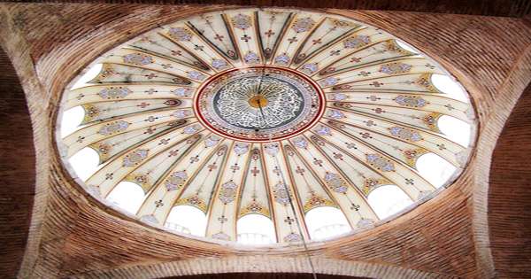
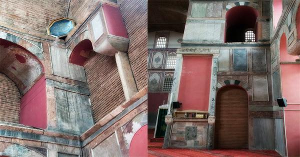
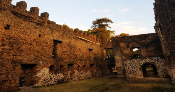
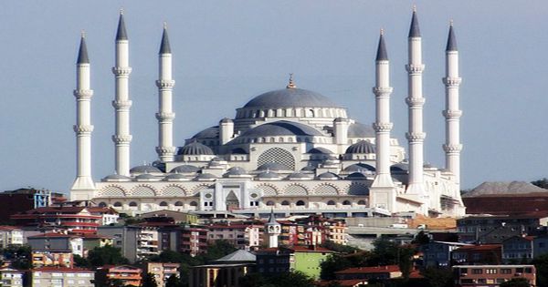
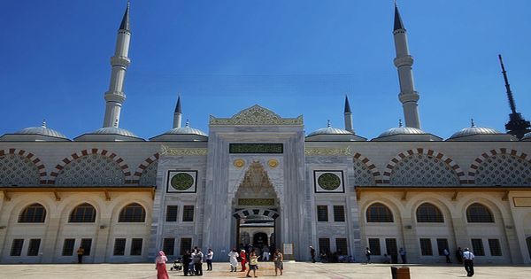
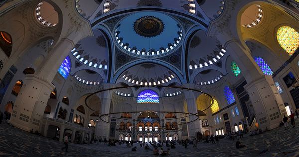
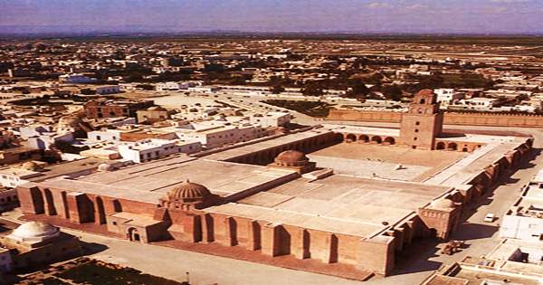
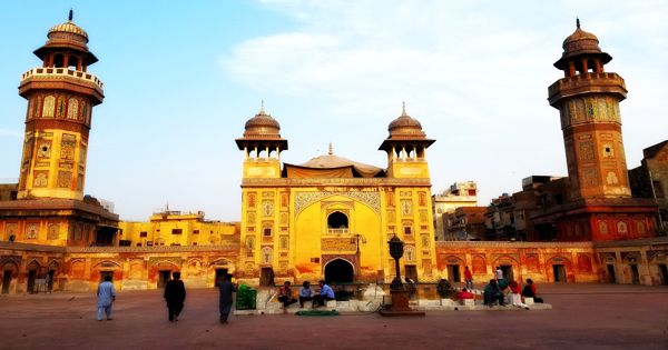
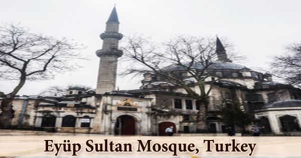
The Eyüp Sultan Mosque (Turkish: Eyüp Sultan Camii) is a very unique and holy mosque for the Islamic world; it is located in the district of Eyüp on Istanbul’s European side, near the Golden Horn, and outside the walls of Constantinople. The current structure dates from the early 19th century. It was the first mosque built by the Ottoman Turks after the conquest of Constantinople in 1453, and it was completed in 1458. The mausoleum marks the location where Abu Ayyub al-Ansari (Ebu Eyüp el-Ensari), the Islamic prophet Muhammad’s standard-bearer and companion, is said to have been buried. Sultan Mehmet II intended to construct a grand tomb to mark the site of Eyüp’s grave, which was discovered outside the city walls shortly after the Conquest. The Ottoman princes came to the mosque complex he commissioned for the Turkish equivalent of a coronation ceremony: the girding of the Sword of Osman to indicate their authority and title as padişah (king of kings) or sultan. The Eyup Sultan Mosque’s decorated dome, which measures 17.5m in diameter and is supported by two half domes, has an elegant architecture. Eyüp’s tomb is possibly more interesting than the mosque itself. It’s open Tuesday through Sunday from 9:30 a.m. to 4:30 p.m., and it’s covered in tile panels from various ages, creating a lovely, if overwhelming, effect. By the end of the 18th century, the mosque had fallen into disrepair, possibly as a result of earthquake damage, and Sultan Selim III ordered the entire building, except the minarets, to be demolished and rebuilt in 1798. In the year 1800, this project was completed. Mahmud II reconstructed the eastern minaret in the original style in 1822.

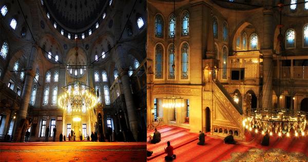
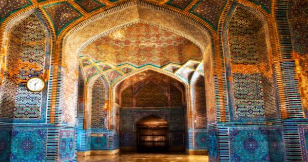
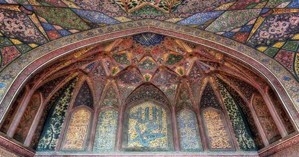
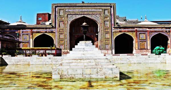
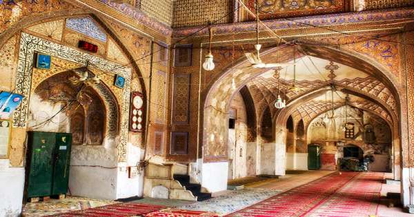
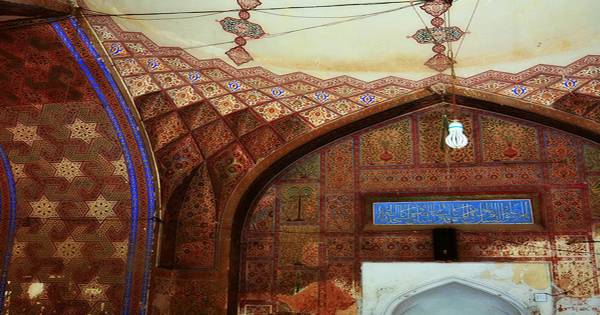
A fun leafy area to walk through is the Eyüp Cemetery, which leads up the hill from the mosque. The Ottoman princes came to the mosque complex he commissioned for the Turkish equivalent of a coronation ceremony: the girding of the Sword of Osman to indicate their authority and title as padişah (king of kings) or sultan. Eyüp Sultan is thought to have died in the 670s during the first Arab siege of Constantinople. Muslims hold his tomb in high regard. The mausoleum is located on the north side of a courtyard, directly across from the mosque’s main prayer hall entrance. Thousands of Muslims flock to the mausoleum on Fridays, which are holy days in Islam. Around the mosque and mausoleum, old trees, flocks of pigeons, praying believers, and visiting crowds create a magical and colorful atmosphere. Tiles from various periods cover the walls of the mausoleum in the courtyard. Turkey’s oldest and most sacred mosque is the Eyüp Sultan Mosque. Its style was altered several times by the Ottomans, who designed it in accordance with their own style of architecture at the time. Mimar Sinan, a well-known Ottoman architect, designed the Eyüp Sultan Mosque. Mimar Sinan was the son of either Greek or Armenian Christian parents. According to historical accounts, this district was also a holy site in Byzantine times, where people came to visit a saint’s grave and pray for rain during droughts. A variety of contrasting panels of Iznik tiles can be found on the mausoleum’s wall facing the mosque. They are from various times and were brought together during the mosque’s restoration in 1798-1799. Iznik tiles are also used to cover the walls of the mausoleum’s vestibule. They date from about 1580 and have the distinctive sealing-wax red slip. Similar tiles to those found in the vestibule can be found in a number of museums outside of Turkey; they likely once adorned the walls of the baths’ now-demolished entrance hall (camekân). The baroque mosque replaces the original, which was demolished in the 1766 earthquake, but the main draw is the türbe, a holy burial site that attracts crowds of pilgrims waiting in line to see the contents of the solid silver sarcophagus or to meditate in prayer. A panel of three blue and turquoise Iznik tiles, dated from about 1550, is housed in the British Museum and is identical to some of the ones that now adorn the shrine’s exterior wall.

read more
ArchitectureHistory

A Visit To A Historical Place/Building (Kalenderhane Mosque, Turkey)

Kalenderhane Mosque (Turkish: Kalenderhane Camii), like Hagia Sophia, Zeyrek Mosque (Pantokrator Monastery), and Fethiye Mosque, is a Byzantine church in Istanbul, Turkey, that was converted into a mosque after the Ottoman conquest of Constantinople in 1453. (Pammakaristos Church). The church was most likely dedicated to the Theotokos Kyriotissa at the time of its building. The structure is also known as Kalender Haneh Jamissi and St. Mary Diaconissa. Despite the discrepancy between the Kalenderhane Mosque and the Monastery of Mary Kyriotissa as described in Byzantine sources, scholars have identified the building as the Church of the Monastery of Mary Kyriotissa based on two frescoes of Mary with the inscription Kyriotissa. Their conclusion also differs from the Ecumenical Patriarchate of Istanbul’s previous identification of the structure as the Church of the Monastery of Christ Akataleptos. This structure is one of only a few surviving Byzantine churches with a domed Greek cross plan. The Church of Theotokos Kyriotissa was built in the twelfth century during the Komnenian Dynasty on top of a fifth or sixth-century Roman bath complex and served as a Greek Orthodox Byzantine church until 1453. Following Constantinople’s conquest in 1453, the church was given to the Kalenderi Dervishes, who used it as a zaviye (Islamic religious school) and imaret (soup kitchen). Despite the fact that the structure has been restored several times due to fires in the late nineteenth century, it continues to function as a mosque. The Greek Cross plan of the Kalenderhane Mosque is supported by a dome within sixteen ribs. The structure’s medium is typical middle Byzantine architecture, which is a combination of brick and stone masonry layers.

Central dome of Kalenderhane Mosque

The mosque is situated at the western end of the existing section of the Aqueduct of Valens (Bozdogan Kemeri), with the aqueduct offset slightly to the south. The current church was built during the late Comnenian Dynasty (1081-1185), incorporating remains of earlier structures built on the site, including a 4th or 5th century private bath, two basilicas predating the iconoclastic era (717-867), and an unfinished 8th century church, according to Kuban and Striker’s field research. The original marble decoration of the structure is still surviving similar as Hagia Sophia and Chora Museum. The church was used as a Roman Catholic Church by the Catholic Crusaders after the Latin Conquest of Constantinople by the Fourth Crusader in 1204, and they adorned the southern chapel of the church with frescoes depicting the life of St. Francis. The only wall mosaic panel from pre-Iconoclast Constantinople is a mosaic panel depicting “the Presentation of Christ,” which was discovered on the apsidal wall of one of the basilicas. The church was used by Catholics during the Latin invasion, according to frescoes found in a diaconicon chapel portraying the life of St. Francesco, the oldest surviving depictions of the saint. Before the Ottoman conquest, the church was surrounded by monastery buildings, none of which survived the Ottoman era. Hacı Beşir Ağa (d. 1747), the Kizlar Ağası of the Topkap Palace, completed the conversion of the building into a mosque in 1746 by constructing a mihrab, minbar, and mahfil. The mosque was reconstructed after being destroyed by fire and earthquakes in 1855 and again between 1880 and 1890. After the minaret collapsed due to lightning and the Medrese was destroyed in the 1930s, it was abandoned. The above-mentioned renovation by Kuban and Striker has restored the original features of the Comnenian church, the 18th-century mihrab, and the minaret, enabling the monument to continue to be used as a mosque.

Interior view of Kalenderhane Mosque

The structure features a central Greek Cross plan with deep barrel vaults over the arms and a 16-ribbed dome. With alternating layers of brick and stone masonry, the building has a typical middle Byzantine brickwork. On the west side, there is an esonarthex and an exonarthex (added much later). Following the Latin attack, the side entrances from the inner narthex were blocked. The upper gallery to the inner narthex was probably demolished during the 1854 restoration, and windows were opened on the northern façade within the grand arch that had been blocked by the gallery. The sanctuary is on the east side, but the restored mihrab and minbar are in a corner to achieve proper Mecca alignment. Prothesis and diakonikon, two small chapels typical of Byzantine churches from the middle and late ages, have survived. The north and south aisles flanking the nave were both demolished at this time, and neither was restored during the 1966 restoration; the triple arches that once linked the nave to the aisles now form the lower tier of windows on the north and south façades. The church’s interior decoration, which includes exquisite colored marble panels and moldings, as well as elaborated icon frames, is mostly intact. The mosque of Kalenderhane is one of the most significant architectural examples of a domed Greek cross church from the Byzantine middle period, alongside the Gül Mosque in Istanbul, the Church of Hagia Sophia in Thessaloniki, and the Church of the Dormition in (Koimesis) in Iznik (Nicaea). The non-extant iconostasis, which rose to the level of the vaults, is commemorated in two intricate icon frames on the piers flanking the sanctuary. The church’s original decoration, which consists of polychrome marble revetments and moldings, has been preserved to a large degree. The minaret rises from the southwest corner of the church and was also restored during the 1966 renovation. The structure has two distinct characteristics, both of which are unique in Istanbul: a one-meter-square mosaic representing the “Presentation of Christ,” the city’s only pre-iconoclastic exemplar of a religious theme, and a cycle of thirteenth-century frescoes depicting the life of Saint Francis of Assisi (found in a chapel at the southeast corner of the building and painted during the Latin domination). These have been partly restored and are now on display in Istanbul’s Archaeological Museum. Other discoveries from the 1966 expedition are on display in a small museum in the Kalenderhane Mosque’s diaconicon.

read more
ArchitectureHistory

Fasil Ghebbi, Ethiopia

The Fasil Ghebbi (Amharic: ፋሲል ግቢ) is situated in the Amhara National Regional State of the Federal Democratic Republic of Ethiopia, in the North Gondar Administrative District. It is a fortress that was built by Emperor Fasilides in the 17th century and served as the residence of Ethiopian emperors. There are eight sections to the serial property. The Castle of Emperor Fasilidas, the Castle of Emperor Iyasu, the Library of Tzadich Yohannes; the Chancellery of Tzadich Yohannes; the Castle of Emperor David, the Palace of Mentuab, and Banqueting Hall of the Emperor Bekaffa are all situated inside the Fasil Ghebbi palace complex. The distinctive architecture represents a wide variety of influences, including Nubian styles.

The remaining seven components are located in and around the city of Gondar: the Debre Berhan Selassie (Monastery and church); the Bath of Fasilidas; Kiddush Yohannes; Qusquam (Monastery and Church); Thermal Area; the Sosinios (also known as Maryam Ghemb); the Gorgora (Monastery and Church) and the Palace of Guzara. In 1979, the site was listed as a UNESCO World Heritage Site. The Amharic word ghebbi means “compound” or “enclosure.” It was designed by Emperor Fasiladas, who became unhappy with his predecessors’ migratory semi-nomadic lifestyle and decided to make a statement by constructing a grandiose palace complex that was one of the most majestic structures of the period.

Interior view of Fasilides’ Palace

Ethiopian rulers often relocated their royal camps between the thirteenth and seventeenth centuries. In 1636, King Fasil (Fasilidas) settled in Gondar and made it his permanent capital. The royal court had grown from a camp into a fortified compound called Fasil Ghebbi, which consisted of six main building complexes and other ancillary buildings, surrounded by a 900-meter-long wall with twelve entrances and three bridges until its decline in the late eighteenth century.

The Fasil Ghebbi has its origins in the Ethiopian emperors’ old custom of moving around their territories, living off the produce of the peasants and sleeping in tents. This precinct was sometimes referred to as a katama (“camp” or “fortified settlement”) or makkababya, the name given to the imperial camp in the Royal Chronicle of Baeda Maryam, reflecting this relation.

The Royal Enclosure, which is enclosed by a 900-meter wall, includes a collection of churches, palaces, and monasteries, each with its own architectural style. Many of the early designs are strongly inspired by Hindu and Arabic architecture, with subsequent occupiers applying their own touches to the pre-existing structures. Later additions display Portuguese, Moorish, and Aksumite influences. Fasil Ghebbi is about 70,000 square meters in size. To the south, Adababay, Gondar’s market place, where imperial proclamations, troops were displayed, and criminals were executed, is now a city park.

Fasil Ghebbi

No one knows why this location was chosen as Ethiopia’s capital, but it was prophesied that an Ethiopian capital would be established at a location beginning with the letter G. The legend spawned a string of towns in the 16th and 17th centuries, including Guzara, Gorgora, and finally Gondar. The fortress city functioned as the center of the Ethiopian government until 1864. Twenty Palaces, royal houses, ornately decorated temples, monasteries, and other unique public and private structures have been transformed by the Baroque style introduced to Gondar by the Jesuit missionaries. Massive towers and looming battlemented walls define the main fortress, which looks like a piece of medieval Europe transplanted to Ethiopia.

Emperor Fasilidas designed Enqualal Gemb, also known as the Egg Castle because of its egg-shaped dome roof, and it is one of the most prominent structures in the compound. The Fasiladas prayer room, which towers above Enqualal Gemb and offers 360-degree views of Gondar, is located above Enqualal Gemb. Dawit’s Hall is situated in the enclosure’s northern portion, near the Bakaffa-built structure and the Asasame Qeddus Mikael church, and is known as the “House of Song.” It was described as a “substantial one-story building with a round tower at the southeast corner,” as well as traces of a smaller round tower at the northeast corner and traces of a square tower at the northwest corner, “the majority of which has collapsed.” “The regular arched windows and doorways offered light and access,” according to the building’s interior, which is a single long corridor.

Dawit’s Hall

The Palace of Iyasu, which was the first to be constructed in the city, is located to the northeast of the complex. The palace was built during the reign of Iysau I (1682-1706), the Gonderine period’s greatest monarch. Iyasu Palace was once decorated with glistening Venetian glassware and decadent gold-plated ivory artwork and is noted for its saddle form and rare vaulted ceilings. A two-story pavilion of a bathing palace associated with Emperor Fasilidas is situated outside the city’s confines to the north-west by the Qaha River. The structure is a two-story battlemented structure that sits inside and on one side of a rectangular pool of water filled by a canal from a nearby river. The bathing pavilion is built on pier arches and has many rooms linked by a stone bridge that can be raised for protection.

Fasil Ghebbi is surrounded by a curtain wall with twelve gates piercing it. The banquet hall and granary are situated to the north of Iysau’s Palace. The building was once decorated in intricate artwork, but during the Italian occupation of Ethiopia, it was sadly plastered over. The last palace on site, Mentewab’s Castle, a two-story castle that now serves as the site office, was designed by Emperor Bakaffa. Following rulers, such as Iyasu the Great, continued to build, improving the techniques and architectural style, and expanding the city to the hills north-west of the city center, in the Qusquam region. Fasil Ghebbi and the other Gondar city ruins show a remarkable interface between internal and external cultures, with cultural elements linked to the Ethiopian Orthodox Church, Ethiopian Jews, and Ethiopian Muslims.

Fasil Ghebbi is open Monday through Sunday from 8:30 a.m. to 17:30 p.m. It is possible to visit the Royal Enclosure in the morning or afternoon. It is often included as part of a larger city tour of Gondar, but it is the city’s main attraction. Gondar remained an important commercial and transportation center for northwest Ethiopia throughout the nineteenth century. Some of the monuments also serve a sacred function, and the surrounding landscape retains important cultural significance for the locals.

Information Sources:

  1. brilliant-ethiopia.com
  2. whc.unesco.org
  3. wikipedia
read more
ArchitectureHistory

Çamlıca Mosque, Turkey

The Grand Çamlıca Mosque (Pronounced: Chamlija; Turkish: Büyük Çamlıca Camii), Turkey’s largest and most impressive mosque, is the product of the Turkish government’s desire to show off the country’s economic strength. It is an Islamic worship center that was completed and opened in March of 2019. The most modern complex of its kind in Turkey, with its art gallery, library, conference hall, art studio, and Museum of Islamic Culture set to open later, as well as a peaceful place for worship, Çamlıca Mosque evokes the atmosphere of mosques commissioned by the Ottoman Empire. The mosque cost US$110 million (approximately 550 million Turkish Lira) and was part of the Turkish government’s megaproject program.

The fine details of the amlca Mosque attract interest, but it also has some special features. Bahar Mzrak and Hayriye Gül Totu, two female architects, led the architectural design planning of the amlca Mosque, which began in the year 2000. The mosque’s design was influenced by Ottoman architecture and Mimar Sinan’s works. The mosque has six minarets, which reflect the Islamic faith’s six pillars. Four of these minarets, each with three balconies, stand 107.1 meters tall and are dedicated to the Triumph of Manzikert, while the other two minarets stand 90 meters tall and have two balconies.

The Grand Çamlıca Mosque, Turkey

This new icon, a futuristic structure with interior spaces built to meet different needs, contains not only an area devoted solely to worship and prayer, but also an art gallery, a library, a conference room, an art studio, and the Museum of Islamic Civilisation, which houses artefacts from Turkish Islamic culture. The new Turkish President, Recep Tayyip Erdoğan, officially inaugurated the mosque on May 3rd, 2019. This practice is expressed in the structure’s architecture, which is reminiscent of mosques constructed in the Ottoman and Seljuk architectural styles.

The mosque’s main dome, which stands 72 meters tall, reflects the 72 nations that call Istanbul home, while the mosque’s 34-meter dome represents Istanbul itself. A 3.12-meter-wide and 7.77-meter-high finial weighing 4.5 tons adorns the mosque’s main dome. Hayriye Gül Totu and Bahar Mzrak, two female architects, led the architectural design planning of Grand Amlca Mosque, which began in the year 2000. The mosque was designed by female architects to accommodate 63,000 people, with special consideration for women, including a separate area for women to pray as well as a childcare area.

The largest mosque in Turkey, it was President Erdoan’s pet project and can be seen for miles (including from ferries making their way up the Bosphorus). The combination of Ottoman and Islamic architecture influenced the design of the amlca Mosque. The design was designed with the likelihood of an earthquake in mind. The main building in these mosques has a Greek cross floor plan with a square in front of it. The project’s planners took into account Istanbul’s earthquake requirements, which is why the mosque will accommodate 100,000 people in the event of an earthquake.

Istanbul Big Çamlıca Mosque Main entrance courtyard

The main gate of the Grand Amlca Mosque is 5 meters long, 6.5 meters high, and weights 6 tons, making it one of the world’s largest mosque gates. The exterior design was heavily influenced by architect Mimar Sinan, the chief builder of the Ottoman classical era. The Suleymaniye Mosque, one of Sinan’s inventions, is visible from the mosque, which is situated on Amlca Hill. The mosque, which is visible from all parts of the city, is rich in features that draw tourists’ attention as they approach it from afar: the six imposing minarets that mark the building’s perimeter reflect the Islamic faith’s six pillars.

The main dome of the amlca Mosque stands 72 meters tall and represents the 72 nations served in Istanbul, Turkey, while the dome spanning 34 meters represents Istanbul (34 is the city’s license plate number). The main dome is 3.12 meters in diameter, 7.77 meters in height, and weights 4.5 tons. The Çamlıca Mosque features a 3,500-square-meter art gallery, a 3,000-square-meter library, a 1,071-seat conference hall, eight art studios, and a 3,500-car indoor parking lot. The mosque has been described as “a classic project that uses modern tools” and cutting-edge techniques in its construction, and it is designed to the highest standards, making it “one of the world’s most earthquake-resistant buildings.”

The Grand Çamlıca Mosque General view

Çamlıca Mosque’s interior was built with a more minimalist architectural approach. The two female designers’ aim was to make people feel more spiritual in the room, and they claimed that they used “light, color, glass, ornamentation, and calligraphy” to achieve this. The L&L Luce&Light outdoor lighting systems selected by Lighting Planner Utku Baksir make the Grand Çamlıca Mosque exceptional, not just in terms of structural protection but also in terms of aesthetics.

Indicating that the Çamlıca Mosque was built not only as a mosque but also as a modern-day complex and a typical Islamic Ottoman social complex. The main dome, which stands 72 meters tall, reflects the 72 nations that call Istanbul home. The minarets are arranged around the dome, with four on even ends and two on the mosque’s outer ends. Various Siri projectors, with adjusted points and hostile to glare recessed optics, have been utilized to light the trees in the garden to one side of the mosque, offering volume to the green foliage: a moving impact, in ideal beneficial interaction with the environment of the place.

Information Sources:

  1. archello.com
  2. dailysabah.com
  3. wikipedia
read more
ArchitectureHistory

Great Mosque of Kairouan, Tunisia

In the historic walled district of Medina, between Rue de la Kasbah and Rue el Farabi, the Great Mosque of Kairouan (Arabic: جامع القيروان الأكبر‎), also known as the Mosque of Uqba (جامع عقبة بن نافع), is located. It is a mosque located in Kairouan, Tunisia, a UNESCO World Heritage Site, and is one of North Africa’s most impressive and largest Islamic monuments. The original mosque was totally demolished, and in the 9th century, much of what stands today was constructed by the Aghlabids. Founded in the year 50 AH (670AD/CE) by the Arab general Uqba ibn Nafi at the founding of the city of Kairouan, the mosque occupies an area of more than 9,000 square meters (97,000 sq ft). It is one of the oldest places of worship in the Islamic world, and a model in the Maghreb for all subsequent mosques. A hypostyle prayer hall, a marble-paved courtyard, and a square minaret are part of its perimeter, approximately 405 meters (1,329 ft).

View of Great Mosque of Kairouan

The mosque, as it stands today, was constructed between 817 and 838 by the Aghlabid governor of Kairouan, Ziyadat Allah. The building was erected on the site of an older mosque, originally founded at the time of the 670 AD Arab conquest of Byzantine North Africa by Uqba ibn Nafi. About 690, shortly after its completion, the mosque was demolished by the Berbers, originally led by Kusaila, during the occupation of Kairouan. The Mosque of Uqba, in addition to its theological prestige, is one of the masterpieces of Islamic architecture, notable for the first Islamic use of the horseshoe arch, among other items. The minaret is the oldest in the Maghreb, and there are 414 pillars supporting horseshoe arches in its impressive prayer hall; non-Muslims can peer into it from the inner courtyard, but can’t enter.

The popularity of the Uqba Mosque and the other holy sites in Kairouan has helped the city to develop and expand. The mosque is situated in the intramural district of Houmat al-Jami, north-east of the medina of Kairouan (literally “area of the Great Mosque”). Although the current mosque retains virtually no trace of the original seventh century building, it is still generally referred to as “Mosque of Sidi Uqba”, or, “Mosque of Uqba Ibn Nafi.” Historically, great importance has been given to it as the first mosque in the first city of Islam in the West. In 703, the Ghassanid General Hasan ibn al-Nu’man rebuilt the mosque. Hisham ibn Abd al-Malik, Umayyad Caliph in Damascus, commissioned his governor Bishr ibn Safwan to carry out construction work in the region, including the renovation and expansion of the mosque around the years 724-728 AD, with the gradual increase of the population of Kairouan and the consequent increase in the number of faithful.

The building is a massive quadrilateral that is slightly irregular, covering some 9,000 m2. It is longer on the east side (127.60 meters) than on the west side (125.20 meters), and shorter on the north side (72.70 meters) than on the south side (78 metres). The principal minaret is north-centered. The exterior has a traditionally unadorned Aghlabid style, with its buttressed walls. When you walk into the vast, marble-paved courtyard, enclosed by an arched colonnade, impressions shift. The courtyard was built to capture water, and the paving slopes to an intricately decorated central drainage hole that delivers the rainwater collected to the cisterns below in the 9th century. The decorations have been crafted to filter the water’s dust. Both of the two wells’ marble rims have deep rope-grooves worn by millennia of water drawing up from the depths.

A number of important additions, including the inclusion of a nearby wide courtyard and the building of a pool now known as the Old Cistern, were made between 703 and 816. (Al-Majal al-Qadim). This time is most frequently attributed to the building of the minaret, although some scholars consider it to be part of the later work of Ziyadat Allah. The next major reconstruction came in 836, when Ziyadat Allah completely rebuilt the sanctuary, including the dome above the mihrab. From the outside, with its 1.90 meters thick massive ocher walls, the Great Mosque of Kairouan is a fortress-like structure, a composite of well-worked stones with intervening rubble stone courses and baked bricks. In 856, by adding a double-arcaded portico to the sanctuary with a domed entry bay, Abu Ibrahim Ahmed started the work that would bring the mosque to its twentieth-century configuration. The portico enveloping the interior of the courtyard is also often assigned to this period; however, some texts cite Ibrahim Ibn Ahmad (874-902) as its builder.

Overview of the building (center), southern façade to the outside (left) and Minaret seen from the courtyard (right)

The three-tiered minaret in the square occupies the northwestern end of the courtyard. In AD 728, the lowest level was built. Note the two Roman slabs at its base (one upside down) bearing Latin inscriptions. On either side, the corner towers measuring 4.25 metres are supported by strong projecting supports. Structurally, the buttressed towers provided stability to the entire mosque given the soft grounds prone to compaction. At the southern end of the courtyard is the prayer hall. The massive, studded wooden doors here date from 1829; especially fine are the carved panels above them. The pillars were, like those of the colonnade, originally Roman or Byzantine, salvaged from Carthage and Hadrumètum (Sousse), and no two are the same.

The complex measures about 70 by 125 meters and is oriented northwest-southeast, being slightly irregular in shape. In 836, the mosque was rebuilt again by Emir Ziyadat Allah I: this is when the structure acquired its present appearance, at least in its entirety. At the same time, the mihrab’s ribbed dome was raised on squinches. The present state of the mosque can be traced back to the Aghlabid era, except for some partial restorations and a few later additions made in 1025 during the Zirid period, 1248 and 1293-1294 under the reign of the Hafsids, 1618 at the time of the Muradid beys, and in the late nineteenth and early twentieth centuries, no feature is older than the ninth century except the mihrab.

Interior view of the hypostyle prayer hall in the Mosque of Uqba
(The Great Mosque of Kairouan)

Six portals, facing northeast and southwest, join the courtyard. The prayer hall, as well as two sheltered doorways from the foot, is entered from the courtyard. At the far end of the main prayer hall, between two red marble columns, you can just make out the precious 9th-century tiles behind the mihrab (niche showing the path of Mecca). For the richly decorated minbar (pulpit) next to them, the tiles were imported from Baghdad along with the wood. The ribbed dome in front of the mihrab has epigraphic and floral decoration and is widely known as a masterpiece of the Aghlabid. With the exception of two domes, one above the mihrab (dating from 836) and one above the portico’s entrance bay, the roof is level (reconstructed in the nineteenth century after its 856 form). The two-bay-deep arcade flanking the courtyard is a later addition, and consists of horseshoe arches resting on rectangular pillars fronted by twin columns.

The Great Mosque of Kairouan has been the subject of numerous accounts by Arab historians and geographers in the Middle Ages for many centuries after its establishment. The stories primarily concern the various phases of the sanctuary’s building and expansion and the successive contributions of several princes to the interior decoration (mihrab, minbar, ceilings, etc.). Abu Ibrahim Ahmed designed the present mihrab, based on the qibla wall. Some scholars claim that Uqba Ibn Nafi’s original mihrab can be seen through the open-work marble of today’s mihrab. Set in a horseshoe-shaped niche, it is surmounted by a semi-dome of curved wooden planks attached to a supporting structure. A gold pigment against the dark backdrop of the wooden half dome is painted in intricate floral designs. In four horizontal rows, twenty-eight white marble panels line the polyhedral interior of the niche of the mihrab. Some of the Western travelers, poets and authors who visited Kairouan sometimes leave their experiences and testimonies tinged with emotion or appreciation in the mosque. On one side, the wooden framework of the maqsura is fixed to the qibla wall and is connected to the arcade pillars with thin iron bands at the inner corners. A door (Bab al-Imam) on the qibla wall and a pair of double doors opening to the sanctuary are accessed via it. Today, the enclosure of Kairouan’s Great Mosque is pierced by nine gates (six openings to the courtyard, two openings to the prayer hall and a ninth opening to the maqsura hall), some of which, such as Bab Al-Ma (water gate) located on the western façade, are followed by prominent porches flanked by buttresses and surmounted by square tholobate-based ribbed domes carrying squinches with three vaults.

Information Sources:

  1. archnet.org
  2. lonelyplanet.com
  3. wikipedia
read more
ArchitectureHistory

Beni Hammad Fort, Algeria

Beni Hammad Fort, also known as Beni Hammad’s Al Qal’a (Arabic: قلعة بني حماد‎), is an imperial Islamic city, now ruined, founded in central Algeria during the eleventh century CE (fourth century AH). It served as the first capital of the Hammadid dynasty in the 11th century. It is northeast of M’Sila, at an elevation of 1,418 meters (4,652 ft), in the Hodna Mountains and receives ample water from the surrounding mountains. It is one of the Islamic civilization’s most interesting and most correctly dated monumental complexes. Near the town of Maadid (aka Maadhid), about 225 kilometers (140 mi) southeast of Algiers, in the Maghreb, is the Beni Hammad Fort. After their freedom from the Zirids and the Fatimids of Tunisia, the seat of the Hammadids was founded by the founder of the Hammadid dynasty, Hammad bin Buluggin I (reg. 1015-1028 CE / AH 406-419), starting in 1007 CE (AH 397).

The settlement developed rapidly into a flourishing metropolis and cultural center from the base of the original qalat, or fortress. In its fortified settlement in the Maadid mountains, Qalat Beni Hammad attracted commercial caravans, scientists, musicians, theologians, politicians, and poets. It was the first capital of the Emirs of Hammad and had great splendor. In 1980, it was inscribed as a World Heritage Site by UNESCO, and described as “an authentic picture of a fortified Muslim city”. Within 7 km of partly dismantled defensive walls, the Qal’a contains a significant number of monumental ruins, including the Great Mosque and its minaret, and a number of palaces. The mosque is the largest after that of Mansourah and its minaret is the oldest in Algeria after that of Sidi Boumerouane, with its prayer hall containing 13 ships out of 8 bays. The Qal’a Ruins bear witness to the great sophistication of North Africa’s Hammad civilization, original architecture, and palatial culture.

Beni Hammad Fort

The primary source summary of the resident city of al-Bakri (1014-1094 CE / AH 404-487) and the historical account of Ibn Khaldun (1332-1406 CE / AH 732-808) testify to the military power of the city as well as its economic and intellectual capital. At the end of the eleventh century, just before the Hilalian incursions precipitated the collapse of the town, the town reached the height of its regional importance during the rule of the later Hammadids. Numerous terracotta, gems, coins and ceramics that attest to the high degree of civilization under the Hammadid dynasty have been brought to light by excavations. Several decorative fountains using the lion as a symbol are also among the discovered artifacts. Three independent residences divided by gardens and pavilions form the ruins of the emir’s palace, known as Dal al-Bahr.

Established as a military fortress in 1007, it was raised to the status of a metropolis. It has inspired the development of Arab architecture, including the Maghreb, Andalusia, and Sicily, as well as other civilizing influences. The key artifacts that attest to the richness and influence of this Hammadid culture are the archaeological and monumental vestiges of the Qal’a of Beni Hammad, including the Great Mosque and its minaret, as well as a number of palaces. The palace of Dar al-Bahr was named for its rectangular pool measuring 67 by 47 meters (220 by 154 ft). To launch a ship, a ramp at one end of the pool was used. In the accounts of contemporary tourists, references to nautical displays in this pool appear.

In central northern Algeria, approximately 110 kilometers south of the Mediterranean coast and 190 kilometers southeast of Algiers, Qalat Beni Hammad is situated. The site is adjacent to Sidi Mohammed el Fadhel’s small village, but the nearest town is M’sila, the modern provincial capital, 26 kilometers southwest of the complex, or 70 kilometers by road. The gardens stretched east-to-west through the city beyond the walls of the palace complex and to a depth of nearly 100 meters (330 ft). Archeologists have not visited the gardens yet, but ornamental fountains have been found.

The city became the capital of the Berber Hammadids, and in 1017 it was under siege by the Zirids. It was abandoned in 1090 under the threat of Banu Hilal and partially destroyed in 1152 by the Almohads. The qalat is located near the peak of Takarbust on the Hodna plateau, the summit of which was enclosed by a large ring of fortifications that established the boundaries of the walled city. The average height of the enclosed city is 990 meters above sea level, while, at its highest point, the Takarbust peak rises to 1418 meters above sea level.

At the time of the inscription, the remains of the 7 km of defensive walls and all the monumental remains found therein were the characteristics that characterize the land. The State Party intends to recommend a revision of the property boundaries and to set up a buffer zone to preserve the exceptional atmosphere of the site. The property’s integrity is guaranteed, but the remains are subject to natural deterioration and weathering. The town is defensively placed to allow a clear view of the plain of Hodna 400 meters below and to the south, while the settlement is bordered by mountain slopes to the north, east, and west. The UNESCO-recognized imperial complex occupies approximately 150 hectares.

Many of the smaller and more modest structures have been lost because of a lack of maintenance or inhabitation in the centuries since the foundation of the city, however, there is evidence of some large buildings. Near its longitudinal core, the mosque is situated in the south of the walled city. The mosque is very large, with a rectangular plan measuring east-to-west 56 meters wide and north-to-south 64 meters long. The longitudinal axis of the mosque aligns with the meridian between the north and the south. At the center of the north wall, a minaret is located, while public entrances open into the mosque courtyard on the east and west walls.

Another architecturally important building inside Qalat Beni Hammad is the Qasr al Manar, also known as the “Castle of the Beacon Light”. Qasr al Manar is a large defensive structure at the edge of a cliff overlooking the Hodna plateau to the south, a fortified projection of the eastern wall of the city. The stone masonry structure is approximately cubic in size, measuring 30 meters wide from east to west and 32 meters long from north to south. The fort also includes a wide reception room at its upper level with a domed ceiling, which opens onto a rooftop terrace. Though primarily a military structure, during times of peace, the Qasr al Manar was built to accommodate imperial diplomatic functions.

Scattered fragments of the eleventh-century building and its decorations have survived elsewhere in the complex. Carved marble water channels, parts of frescoes within the palaces, ceramic pottery, marble sculptures, crystal and glassware are among the artworks. Carved stone friezes, carved stone and plaster muqarnas, and multicolored tiles made using multiple artisanal techniques are architectural remnants. In the modern period, the site was identified by the French historian Méquesse in 1886. In 1908 CE, under the supervision of the French archaeologist de Beylié, modern excavations of the site were first carried out. Later excavations were undertaken by Lucien Golvin between 1951 and 1952 CE, and after 1964 CE under Bourouiba. The 150-hectare Qalat Beni Hammad site was named in 1980 as a UNESCO World Heritage Centre.


Information Sources:

  1. archnet.org
  2. whc.unesco.org
  3. wikipedia
read more
ArchitectureHistory

Shah Jahan Mosque, Thatta, Pakistan

The Shah Jahan Mosque (Urdu: شاہ جہاں مسجد‎), also known as the Jamia Masjid of Thatta, is a building from the 17th century that serves as the central mosque for Thatta town, in the Sindh province of Pakistan. Since 1993, it has been on the tentative UNESCO World Heritage list. During the reign of Mughal Emperor Shah Jahan, the mosque was built and given to the city as a token of gratitude. The mosque is considered to have the most elaborate display of tile work in South Asia, and a decorative feature that is uncommon for Mughal-period mosques is also important for its geometric brickwork. The Shah Jahan Mosque was built as a gift to the people of Sindh by the eponymous Emperor. It is constructed mainly of heavy brick and is laid out with a wide (52 × 30 meters) courtyard at its center in the normal quadrilateral arrangement. With 93 domes of varying scale, the arcades around the courtyard are covered. One impressive acoustical aspect is that it is possible to clearly hear the prayers of someone speaking loudly in front of the mihrab (the prayer niche facing Mecca) in the building.

The mosque was constructed during the reign of the Mughal emperor Shah Jahan, who gave it to the city as a token of gratitude, and is strongly influenced by the architecture of Central Asia, a reflection of the campaigns of Shah Jahan near Samarkand shortly before the mosque was planned. The mosque is situated in eastern Thatta, in the 16th and 17th centuries, the capital of Sindh, before the capital of Sindh was transferred to nearby Hyderabad. It is situated next to the UNESCO World Heritage Site, the Makli Necropolis. The site is situated about 100 kilometers from Karachi.

Intricate floral designs of Shah Jahan Mosque

Thatta is an ancient city with a history that is as vast as it is rich. As the medieval capital of the Sindh province of Pakistan, over its long history, Thatta has come to know several different rulers. All of these different rulers and their respective cultures have left their effect on this diverse region, but maybe no one has left an influence on the city more than the Mughal Emperor Shah Jahan of the 17th century. After his rebellion against his father, Shah Jahan sought refuge in Thatta from his father, Emperor Jahangir. Shah Jahan was pleased by the hospitality he received from the Sindhi people and, as a gesture of gratitude, ordered the building of the mosque. The building of the mosque may also have been partly motivated by a desire to help mitigate the effects of a destructive storm that hit the city in 1637 and almost destroyed Thatta.

Since its central components were completed sometime between 1644 and 1647, the majestic building served as the main mosque of the town. It should be remembered, however, that the building was not formally consecrated until 1647, and the eastern complex of the building was not completed until 1659, during the reign of the Mughal emperor Aurangzeb. The architectural style of the Shah Jahan Mosque is overtly inspired by Turkic and Persian styles. The mosque is distinguished by extensive brickwork and the use of blue tiles, both of which were directly affected by Central Asian Timurid architectural styles from where the former Sindh rulers, the Tarkhans, had hailed before the Mughals annexed the area in 1592.

A panoramic view of the mosque’s courtyard, showing three of the mosque’s four iwans

A 169’×97′ courtyard centers around the mosque, a heavy brick building of simple construction constructed on a stone plinth, with heavy square pillars and massive walls. The chamber of prayer is close in size. Big domes cover both of them. The Mihrab of the mosque was originally wrongly identified with Mecca. It is said that the Sufi mystic, Makhdum Nooh, who is buried in the nearby city of Hala, was approached by the architects of the mosque in order to correct its alignment. Popular tradition holds that Makhdum Nooh then, through the force of his prayer, corrected the mistake overnight, thus guaranteeing his status as a saint. Historical records indicate that the Mihrab of the mosque was only restored a century after the building of the mosque.

The mosque is famous for its beautiful architecture, possibly imported from another Sindh town of Hala, with red bricks and blue glazed tiles. The mosque has a total of 100 domes and is the largest mosque in the world with such a large number of domes. It was built with acoustics in mind. At the other end, a person speaking within one end of the dome can be heard. Since 1993, it has been on the tentative UNESCO World Heritage list. The alignment of the mihrab is said to have been fixed overnight after the Sufi mystic prayed to God to repair the mishap, after which he became a respected Islamic saint. Of course, though it is more fun to believe in this myth, documents exist that indicate that a century after the mosque was originally built, the mihrab was restored and properly aligned.

Two aisled galleries open to the courtyard through arcades to the north and south. Ninety-three domes cover the entire structure, and are probably the source of a remarkable echo that allows every part of the building to hear the prayers in front of the Mibrab. It was not until 1658-59 that the building’s eastern portion and the gateway were finished. Subsequent repairs were conducted in 1692 under Emperor Alamgir and in 1812 under the auspices of Murad Ali Khan Talpur, a local chieftain. During the British era, further renovations took place in 1855 and in 1894. More recently, during the 1960s and 70s, the mosque was rebuilt.

The mosque’s arched prayers area

The tiles of the mosque reflect a direct influence of the style of Timurid. Cobalt blue, turquoise, manganese violet, and white tiles are used in the mosque. In the Indo-Pakistan sub-continent, the mosque features the most intricate display of tile-work. The two principal chambers, in particular, are absolutely filled by them. The dome of the mosque is decorated with elegant blue and white tile-work designed to represent the heavens in stellar patterns. Its walls, signed by Abdul Ghafur and Abdul Sheikh, feature calligraphic tile work. Stylish floral patterns decorate the spandrels of the main arches, comparable to Iran’s Kashi work of the seventeenth century, and geometrical designs on square tiles are disposed of in a sequence of panels elsewhere.

The architecture of the mosque is what makes this site so special, as well as a must-see on anyone’s trip to Pakistan’s Sindh region. The building is a blend of styles from the Central Asian influences of Turkish, Persian, and Timurid. The building is very unique in that it is one of the few mosques with almost no minarets present. The architecture of the mosque may have been inspired in Kachhpura, near the city of Agra, in modern-day India, by the conservative Timurid-style Humayun Mosque. A Persian-style Charbagh, or quadrangle garden, is the primary entryway into the mosque complex. To the west of its central courtyard, which features iwans, or doors, in each of its four cardinal directions, is the main prayer space. Rectangular in shape, the courtyard measures 169 feet by 97 feet. It is surrounded by aisled galleries, with 33 arches surrounding it. The mosque does, however, boast 93 domes, more than any other building in all of Pakistan.

To represent the celestial atmosphere of the sky, the inside of the main dome is painted with stellar patterns of blue, white, red, and yellow tiles. The main dome’s walls are also littered with exquisite Arabic calligraphy. Prayers in the entire building can be heard in the main prayer space. Emperor Aurangzeb in 1692, as well as Murad Ali Khan Talpur in 1812, carried out restoration works. The mosque has been on the UNESCO tentative list of World Heritage Sites since 1993, but official recognition has not yet been achieved.


Information Sources:

  1. aroundpakistan.com
  2. whc.unesco.org
  3. orientalarchitecture.com
  4. wikipedia
read more
ArchitectureHistory

Wazir Khan Mosque, Lahore, Pakistan

The Wazir Khan Mosque (Punjabi and Urdu: مسجد وزیر خان ; Masjid Wazīr Khān) is the most intricately decorated mosque of the Mughal period of the 17th century which retained its position as the main place of worship in the old town of Lahore, the capital of the Punjab province of Pakistan. Shaikh Ilm-ud-din Ansari, the Viceroy of Punjab under Shah Jahan, founded it in 1634. The mosque is on the Tentative List of UNESCO World Heritage Sites. Wazir Khan Mosque, considered to be the most ornately decorated Mughal-era mosque, is renowned for its intricate work of faience tiles known as kashi-kari, as well as its interior surfaces almost entirely embellished with elaborate frescoes from the Mughal era. Near the Delhi gate of the walled city of Lahore, it stands tall, leading through a busy bazaar where tourists can hear the blaring horns and quibbling voices of busy clients through the walls of the mosque.

Façades facing the mosque’s courtyard are embellished with intricate kashi-kari tile work

This mosque and its associated structures were founded in 1044-45 AH by Hakim’Ilmuddin Wazir Khan, the Subedar of Lahore during the reign of Emperor Shah Jahan (1634-35 CE). This was the largest mosque in Lahore at the time, situated about 260 meters inside the Delhi Gate. Since 2009, under the direction of the Aga Khan Trust for Culture and the Government of Punjab, the mosque has undergone comprehensive renovation, with donations from the governments of Germany, Norway, and the United States. Visitors can find complex fine patterns decorating the wall mosaic style that contribute to the uniqueness of the mosque, also known as kashi kari, fresco painting, engraved stones, and brick outline fresco (taza kari).

A bathhouse (Shahi Hammam) and other commercial establishments were also built by Wazir Khan along the road to the mosque, whose income was intended to ensure the perpetual maintenance of the mosque. The bazaar to the east of the mosque was very prosperous and remains a thriving market even to the present day, although the bathhouse did not provide as much revenue as expected. The Mosque of Wazir Khan was built around the ancient tomb of Saint Syed Mohammad Ishaq Gazrooni, best known as Miran Badshah. In the 13th century, he migrated from Iran and lived in Lahore during the Turkish-Muslim Tughlaq Dynasty era. The mosque was part of a larger complex that included a row of bazaars used for restoring holy books and painting Quranic verses by calligraphers and bookbinders.

View of Wazir Khan Mosque, Lahore, Pakistan

The trust included additional shops built into the body of the monument on the eastern and northern facades, a serai, a public bathhouse (the Shahi Hammam), open land, and two wells, all bequeathed by Wazir Khan to the mosque for its preservation and maintenance. The hujras that lined the forecourt (which may also have been the serai mentioned in the deed) also served as alcove rooms for traditional craftsmen to sell their products during the Mughal period. Wazir Khan Mosque features South Asia’s first example of a purpose-built Central Asian charsu bazaar, or four-axis bazaar, while two of the four axes are aligned as the entryway of the mosque in the Wazir Khan Mosque adaptation, whereas the other two form the Bazaar of the Calligrapher.

The interior of the mosque was richly embellished with frescoes synthesizing the decorative styles of Mughal and local Punjabi, while the exterior of the mosque was lavishly decorated with intricate kashi-kari tile work in the Persian style. The mosque of Wazir Khan superseded the older Maryam Zamani Mosque as the largest Lahore mosque for Friday prayers for congregations. The mosque is entirely constructed of cut and dressed bricks laid in kankar lime with a scanty sprinkling of red sandstone in the gate and transept, covering an overall area of 279 × 159′. The courtyard is divided into two parts: with the ablution tank in the center, the upper portion is around 6′ higher than the lower.

The underside of the dome has intricate designs reflecting Persian and Islamic architecture

In the Walled City of Lahore, Wazir Khan Mosque is situated along the southern side of Lahore’s Shahi Guzargah, or “Royal Road” (1.6 km), which was the traditional route crossed by Mughal nobles on their way to the Lahore Fort’s royal residences. The building started in 1634 A.D. Only a short walk from the Lahore Fort, as Emperor Shahjehan used to give his Friday congregational prayers in Wazir Khan Mosque, the mosque holds great significance. Many Mughal emperors rode through the Delhi Gate to the Fort of Lahore on horses. A town square known as Wazir Khan Chowk, and the Chitta Gate also face the mosque.

The abundant architectural decorations that embellish the mosque’s exterior and interior surfaces are the unique outstanding feature that positions the mosque at the forefront of the world’s great monuments. Under the reign of the Mughal Emperor Shah Jahan, construction of the mosque began in either 1634 or 1635 and was completed in about seven years. In the late 1880s, in the former Journal of Indian Architecture, John Lockwood Kipling, the father of Rudyard Kipling, wrote about the mosque and its decorative elements. Fred Henry Andrews, the British writer, noted in 1903 that the mosque had fallen into disrepair. The mosque of the Mughal period is rectangular, measuring approximately 282.7 × 165.4 feet, having four imposing minarets marking the corners of the main courtyard.

The distinctive architectural characteristic of the mosque is the use of minarets at each of its four corners, the first time that such a style was used in Lahore. The prayer hall follows the one-aisle five-bay motif first developed at the Maryam Zamani Mosque a generation earlier in Lahore, which was later to find its full expression in the Badshahi Mosque founded half a century later by Emperor Aurangzeb. Glazed tile mosaics (kashikari), frescos (naqqashi), typical engraved lime plaster, and cut-and-dressed brickwork are included in this extensive ornamentation. In Arabic and Persian, delicate calligraphy portrays verses from the Quran and the Hadith, includes references to the date of the mosque’s building and recognizes its founder and the Emperor.

The main prayer hall opens to an ablution pool

The Wazir Khan Mosque’s outer circumference is 279 feet (85 m) by 159 feet (48 m) and the long axis is parallel to the Shahi Guzargah. It was constructed with bricks laid in the lime of kankad. The courtyard is flanked by 32 small hujras of varying sizes on its east, north, and south sides. On the west side, the prayer chamber is split into five compartments by massive piers with broad, four-centered arches and a dome crowning each compartment. A small space has been installed in the central portion at the northern and southern ends of the prayer hall, although there is a gallery opening into the spiral staircase on the eastern end lending to the roof. Wazir Khan Mosque’s construction is most representative of the architecture and style of the Mughal period, with bricks and tiles adorning the walls. The mosque entrance is through a wide Aiwan that faces the Chowk of Wazir Khan. The Islamic declaration of faith is inscribed above the Aiwan.

Bricks facing the exterior of the mosque are richly embellished with the title work of the Persian style known as kashi-kari. The façades facing the inner courtyard are richly decorated with motifs and palettes that show clear Persian influences from the 17th century. Colours used in the Persian style include lajvard (cobalt blue), firozi (cerulean), white, green, orange, yellow, and purple, while star-shaped flowers and grapevines are Persian-influenced motifs. The four corner minars (minarets), the five domes, and the transept at the east entrance gate are the key structural features of distinction. The central hall, designed according to Persian architectural specifications, is the largest prayer hall. The wide dome stands on four arches, which makes the Char Taq more widely known as a square pavilion. The underside of the dome is painted with frescoes that depict an Islamic depiction of a paradise intricately built.

For Mughal-era mosques, the interior decorative design is peculiar, as it blends imperial Mughal elements with local Punjabi decorative styles. Of all the mosques constructed during the Mughal era, the Wazir Khan mosque has the best mosaic tile work. The Quran’s verses are seen as exquisite works of calligraphy adorning the walls. There is a square pavilion in the main prayer hall over which the largest dome of the mosque rests in a Persian shape known as Char Taq. Another fascinating fact about the Wazir Khan mosque is that, at that time, it was the first mosque of its kind in Lahore. Later, the same trend was followed by other mosques, such as Badshahi Mosque.

Of all the mosques constructed during the Mughal era, the Wazir Khan mosque has the best mosaic tile work. The Quran’s verses are seen as exquisite works of calligraphy adorning the walls. Around 160 feet by 130 feet, the courtyard features high arched galleries surrounding a central paved brick courtyard, a typical feature of Iran’s imperial Persian mosques. The courtyard of the mosque includes a pool used for washing the Islamic rite, wudu, measuring 35 feet by 35 feet. The distinctive blend of calligraphy, geometric forms, Persian motifs, and floral designs gives the building an unhindered touch of grandeur and opulence.

The mosque’s courtyard

The integration of 22 shops into its ground layout is a peculiar characteristic of the mosque. These stores, situated on either side of the entrance hall, form a bazaar with a brick-paved passage in between. This business area stretches east beyond the mosque into Chowk Wazir Khan (Wazir Khan Square), which to this day remains a vibrant business district. The mosque complex is part of the Protected Heritage Monuments of the Punjab Department of Archaeology. The site was added to the UNESCO Tentative List for the Status of World Heritage Sites in 1993. Restoring the Chowk Wazir Khan would provide a designated, well-maintained, and well-furnished public space for the residents and visitors of the Walled City where cultural, social, and regulated commercial activities can take place in a historical setting.


Information Sources:

  1. orientalarchitecture.com
  2. zameen.com
  3. archnet.org
  4. wikipedia
read more
ArchitectureHistory

Royal Palace Of Caserta, Italy

The Royal Palace of Caserta (Italian: Reggia di Caserta (ˈrɛddʒa di kaˈzɛrta)) was built on the orders of Charles III of Bourbon, the genius of Luigi Vanvitelli, who wanted an icon to show the influence of the Bourbon dynasty. It is a former royal residence in Caserta, Southern Italy, established as the principal residence of the kings of Naples by the House of Bourbon-Two Sicilies. It is the largest palace erected during the 18th century in Europe. The palace was declared a UNESCO World Heritage Site in 1997; its nomination described it as “the swan song of the spectacular art of the Baroque, from which it adopted all the features needed to create the illusions of multidirectional space.” This palace is one of the most important monuments in the history of Naples, and one of the most interesting places in our country.

Royal Palace of Caserta

The Caserta Royal Palace and Park, north of Naples, was designed according to the wishes of Charles of Bourbon III by Luigi Vanvitelli, one of the greatest Italian architects of the 18th century, mixing the styles of Versailles, Rome, and Tuscany. In terms of height, with a surface area of 47,000 m2, the Royal Palace of Caserta is the largest royal residence in the world with over 1 million m3. The main façade has 143 windows, 1200 rooms, and 34 staircases standing as an exaltation of Baroque Italy. Caserta is considered a triumph, and ahead of its time, of the Italian Baroque. Expanding over 11 acres, the ponds, fountains, and cascades of the garden are aligned by a ‘telescope effect’ that reaches as far as the eye can see.

Caserta Royal Palace and Park is one of the last great European gardens, borrowed from creations such as Versailles and villas in Rome and Tuscany in the 16th century. Charles VII of Naples (Charles III of Spain), who worked closely with his architect, Luigi Vanvitelli, began the building of the palace in 1752. When Charles saw the grandly scaled model of Vanvitelli for Caserta, it filled him with “fit to tear his heart from his breast” emotion. In the end, when he abdicated in 1759 to become King of Spain, he never spent a night in Reggia, and the scheme was only partly completed by his third son and successor, Ferdinand IV of Naples.

A few kilometers from the capital, Naples, the building (palace) was constructed, prompting an urban project that would reflect the power of the Bourbon family. Caserta Vecchia’s population was moved 10 kilometers to provide a workforce closer to the palace. In the immense parkland, the silk factory at the San Leucio resort was disguised as a pavilion. It was the first Italian landscape garden, for instance. But the reasons also stemmed from the patterns spreading across Europe at the time, namely providing the royals with leisure and accommodating botanical study. Hundreds of rare and precious plants were brought to Caserta from around the world and still grow there today.

Inner view of the Royal Palace of Caserta

It was made with influence from that of Versailles at the wishes of the king, but Vanvitelli produced a unique work, a synthesis of the architecture of three centuries, going to summarize what was the paradigm of neoclassical architecture, due to the discovery of Herculaneum and Pompeii’s lost cities. Importantly, since it reflects the shift in approach in the relationship between royals and the rest of the world, the design was also singular. The architecture included a silk factory and associated workers’ homes, and the natural forests were integrated. In material form, it is an eloquent manifestation of the Enlightenment, incorporated into its natural environment rather than forced upon it.

The palace was the site of the Accademia Aeronautica, the Italian Air Force Academy, from 1923 to 1943. The Royal Palace served as the Allied Force Headquarters for the Supreme Allied Commander in the Mediterranean region, Sir Maitland Wilson and later Sir Harold Alexander, from 1943, during the Allied invasion. The Palace was built as an enormous building with twin facades, one facing the parade ground, the other facing the gardens. In the original plan, the central dome and the statue of Charles on the gable in the center of the facade were present but were never realized.

There are 5 floors in the palace, 1,200 rooms, including two dozen state apartments, a large library, and a theatre modeled after Naples’ Teatro San Carlo. After the King left the kingdom, the gardens were finished, and in 1762, through the Caroline aqueduct, the water from Maddaloni entered the Palace. The royal rooms date from the late 18th century and the “new apartment” dates from the early 19th century. Within, three octagonal vestibules leading to the four courtyards link to the vaulted arcade, distinguished by niches and wide corner apses.

It is difficult here to identify the Palace and its gardens. It is one of the world’s most famous and most appreciated architectural masterpieces. The palace has a rectangular plan, measuring 247 m x 184 m, and two orthogonal arms link the four sides, creating four inner courts. Each floor measures approximately 47,000 m2 (505,904 sq ft), but the entire palace measures 235,000 m2 considering the five floors (2,529,519 sq ft). In 1997, the palace was designated a UNESCO World Heritage Site its nomination file described it as “the ‘swan song’ of the spectacular art of the Baroque period, from which it adopted all the features needed to create the illusions of a multi-directional space.”

The Diana and Actaeon Fountain at the feet of the Grand Cascade

The entrance is from the upper hall to the Palatine Chapel (similar to the one in Versailles). The Chapel, with columns and a high stylobate, is an unadorned and vaulted space. The Christmas Eve Mass in 1784, in the presence of the King and all of the Court, was inaugurated. Mary Immaculate, whose portrait is painted on the apse, is dedicated to the chapel. With more than 2 million cubic meters, Caserta is by far the largest royal palace in the world in volume (70 million cu ft). A jumble of buildings appeared behind the facades of its corresponding segmental ranges of outbuildings that surround the giant forecourt to facilitate everyday business. The palace includes four courts with a well-proportioned interior that evokes a monotonous dignity, unique in its time, featuring what scholars describe. There are more than 40 monumental rooms in the royal palace, completely decorated with frescoes, while Versailles has only 22 monumental rooms.

The throne room

Starting from the palace’s back façade, the park flanks a long promenade with artificial fountains and waterfalls. There is also a magnificent botanical garden, built in the 1780s, called “The English Garden.” At intervals along a wide straight canal that runs to the horizon, the fountains and cascades, each filling a vasca (basin), with design and hydraulics by Luigi Vanvitelli, rivaled those at Peterhof outside St. Petersburg. At the top of the park, beginning in 1785, Vanvitelli and the German botanist John Andrew Graefer designed the first Italian landscape garden at the behest of Queen Maria Carolina.

The Rooms of the Seasons, the small and highly decorated rooms, must be listed. The King and Queen welcomed their most intimate guests in the “spring” room, and Hackert embellished it with some splendid harbor views. Contemporary observers noticed that all the other royal palaces in Europe, including their models, were exceeded by the Caserta in one specific aspect: the combination of completeness and stabilization. Caserta’s Royal Palace is a year-round resort, but in spring and summer, its vast gardens are at their finest. On Tuesdays, the complex is closed.


Information Sources:

  1. isitworldheritage.com
  2. realcasadiborbone.it
  3. wikipedia
read more
ArchitectureHistory

Begum Shahi Mosque, Pakistan

Begum Shahi Mosque (Urdu: بیگم شاہی مسجد‎), officially The Mosque of Mariyam Zamani Begum (Urdu: مریم زمانی بیگم کی مسجد‎), is the Mughal era’s oldest surviving monument and is also regarded as the Mother of all Mosques. Located in the Walled City of Lahore, Punjab, Pakistan, it is an early 17th-century mosque. The title given to Wali Nimat Begum, one of Akbar’s wives, is Maryam Zamani (also spelled Mariam Zamani), who later became the mother of Crown Prince Salim Jahangir. Some historians say that she is the daughter of Amer’s Raja Bharmal, while some claim that she was Akbar’s Portuguese wife. The mosque was built in honor of his mother during the reign of Mughal Emperor Jahangir between 1611 and 1614. It is Lahore’s earliest surviving example of a mosque from the Mughal period, and a few decades later inspired the building of the larger Wazir Khan Mosque. This mosque was converted under Sikh rule in the name of the most celebrated Sikh hero, Bhai Mani Singh ji, as Shaheed Ganj Bhai Mani Singh.

The gate of the Walled City that leads directly to this mosque is the Gate of Masti. The gate, constructed in 1566 by Akbar, was the original main gate of the fort. This gate became known as Masjidi Gate because of the mosque just opposite it (also known as Masti Gate, a corruption of Masjidi). There is no longer a doorway, but a directional sign will take you there on the circular route. Historians claim that after this mosque and as Masjidi Gate, Masti Gate was named; the name was corrupted to Masti Gate as known today over the course of time.

Begum Shahi Mosque

Several shops have entered the mosque, and views of the mosque from the Akbari Gate of Lahore Fort have been obstructed by illegally developed tyre shops. The mosque is located right in front of Lahore Fort’s Akbari Gate. Legend claims that an underground tunnel originally linked the mosque to the fort so that royal women could come to this mosque to give prayers and return unnoticed. The Walled City of Lahore Authority declared in July 2016 that the shops would be closed, and the mosque would be retained and restored as well.

This Mughal mosque in Lahore is the first to have a five-bay facade, according to various architects, which became the key template for many mosques designed on the subcontinent by the Mughals. The mosque was built in honor of his mother, Begum Mariam-uz-Zamani, who was also known as ‘Maharani Jodha Bai,’ during the reign of the Mughal Emperor Jahangir. For representatives attending the Mughal court, the mosque possibly acted as the main mosque.

This mosque, known as Begum Shahi Mosque, is Lahore’s oldest surviving Mughal mosque. It is also named “Lady of the Badshahi Masjid” With brick masonry, the mosque is completed and rendered with plaster. It is a very small structure compared to Wazir Khan and the other mosques of his day. Initially, an area of 135 ft by 127 ft was occupied by the mosque, which has now been reduced due to some commercial and residential areas developed around it; invasions are also a factor. The architectural style is an Afghan and Mughal hybrid. It is the first to show a five-bay front, which later became the standard style of almost all Mughal mosques, experts say. On its north and east sides, it has two entrances. There is a waste tank in the middle of the courtyard. Another attribute of the mosque is that it has twin domes.

The mosque features a series of low domes

In 1611, work started and lasted until 1614. Some part of the mosque was converted into Shaheed Ganj Bhai Mani Singh, where Maharaja Ranjit Singh temporarily transformed some part of it into a gunpowder factory, for which it was then known as Barudkhana Wali Masjidh (“Gunpowder Mosque”). The mosque was restored to the Lahore Muslims in 1850, who were able to contribute to its reconstruction. The presence of vibrant fresco work inside is characterized by the mosque. The color combination is splendid. These exquisite fresco decorations are replete with the entire interior of the prayer hall, which are unrivaled in Pakistan for their delicacy and lively variety.

A water cistern for ablution is in the center of the mosque’s courtyard, now in a very restored shape and has lost the original look. The courtyard was lined with brick tiles, but new brick has now been fully re-laid. The mosque features the first five-bay prayer room in Lahore, which would later be characteristic of all later Mughal mosques, such as the Wazir Khan Mosque and Badshahi Mosque. The central bay of the mosque is in the Persian Char Taq style and is flanked on either side by a smaller dome. Originally, the mosque had 3 gateways, 2 of which survive.

The chamber of prayer, 130′-6″ long and 34″ wide, is split into five compartments. A medallion with radiating stellate and net forms made in stucco is at the center of the main dome. The tiny space in between is filled with stars in Naskh characters bearing the names of Allah. The designs, including flower pots, cypresses, and palms, are floral and geometrical. A courtyard measuring 128 by 82 feet, which has an ablution pool for Islamic ritual washing, is also in the mosque.

Under Sikh law, this mosque suffered considerable damage. Maharaja Ranjit Singh used it as a gunpowder plant. It came to be known, therefore, as Barud-khana Wali Masjid. During the British time, the mosque was restored to Muslims by Major McGregor, Lahore’s Deputy Commissioner, in 1850. The mosque’s interior features extensive Mughal fresco work, and a few decades later it would be the model for the intricate and extensive frescoes at the Wazir Khan Mosque. Most frescoes are floral in nature and non-Quranic text is used in calligraphy on the walls, and it is the first mosque to feature this tradition in Lahore.

The mosque’s walls feature elaborate frescoes

Geometric, floral, and inscriptional stucco ornaments are treated to the central mehrab arch. In other buildings and monuments, such geometrical designs are uncommon and seldom found. Some pieces were flaked away from the fresco and some were painted with whitewash. On the ceilings and elevated walls and corners, the fresco is mostly intact. The mosque contains Quranic and non-Qur’anic inscriptions. An inscription features a Persian inscription over the northern gateway that reads:

God be thanked through whose grace, under the auspices of His Majesty, this building was completed. The founder of the edifice, the place of salvation, is Queen Mariyam Zamani. For the completion of this edifice, which resembles paradise, I was thinking about when at last I found it in the words “What a fine mosque!”

The significance of the mosque also lies in the outstanding paintings known as ‘monnabat kari’ that are an example of artistic work. It is characterized as the art of decorating the surface of objects painted or made of ivory, wood and brass with twisted wire laid side by side with small equilateral triangles that result in a geometric pattern. The mosque is no longer a tourist attraction anymore; it was surrounded by invasions from all sides, a rim market on one side and a Moti Bazar shoe market on the other. There were also several houses constructed nearby. This region that was once invaded was part of the mosque and the circular garden.

Views of the mosque have been obstructed by illegally constructed shops that have surrounded the mosque. The mosque has been ravaged by invasions, a lack of maintenance, and pollution. On its walls, cracks of tears formed and the artwork faded with the passing of time. From the rooftop of Akbari Gate of Lahore Fort, the domes of the mosque can be seen, except that it is not much visible unless visitors/tourists walk into the markets crossing the alloy rims and shoes.


Information Sources:

  1. notesonindianhistory.com
  2. pakistantoday.com.pk
  3. wikipedia
read more